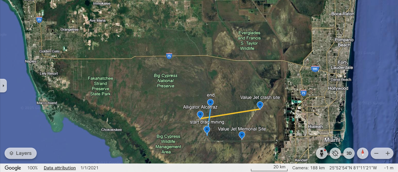
This is a map using Google Maps to show where Alligator Alcatraz is in relation to some of its surroundings.
The concentration camp is about 20 miles west of where the Value Jet flight 592 crashed in 1996. See location markers.
Also on the map, running north and south is a 9 mile section about 2-1/2 miles to the east of the camp. This is actually a series of canals that were man-made canals dug by drag mining for rock to build US 41, The Tamiami Trail, that was completed in 1928. We fished those canals a long time ago. At the northern end of those canals there were enough alligators that we joked that if someone was fast enough, he could run across their backs to reach the other side of the pond. There really were that many. Zooming in reveals a zig-zag in the road, locals call the eastern curve the 40 mile bend, and the western one the 50 mile bend.
ValuJet Flight 592 crash investigation
ValuJet Flight 592 was a tragic aviation disaster that occurred on May 11, 1996, shortly after takeoff from Miami, en route to Atlanta. The flight, carrying 105 passengers and 5 crew members, crashed into the Florida Everglades, resulting in no survivors. The investigation revealed that the fire, likely caused by improperly stored oxygen generators, spread rapidly, leading to the loss of control of the aircraft. This incident highlighted significant deficiencies in both ValuJet's operations and maintenance practices, particularly its subcontractor, SabreTech. The National Transportation Safety Board (NTSB) later criticized the Federal Aviation Administration (FAA) for not enforcing safety recommendations, which ultimately led to a shift in the FAA's focus from promotion of the industry to prioritizing safety.
https://www.ebsco.com/research-starters/science/valujet-flight-592-crash-investigation

 = new reply since forum marked as read